
+70
°
F
+74°
+58°
Niagara Falls
Thursday, 16
See 7-Day Forecast
Featured News - Current News - Archived News - News Categories
Lake-effect snow to impact areas off Lake Erie & Lake Ontario through at least Tuesday
√ Areas off Lake Ontario could see 2 to 3 feet; areas off Lake Erie in southern Buffalo metro area could see up to 1.5 feet
√ New Yorkers can sign up for weather & emergency alerts by texting 333111
Submitted by the Office of Gov. Kathy Hochul
Gov. Kathy Hochul on Sunday updated New Yorkers on the state’s preparations ahead of lake-effect snow set to impact areas east of Lake Erie and Lake Ontario through at least Tuesday night. Following a system that will bring up to 5 inches of snow to the Mid-Hudson, New York City and Long Island regions on Sunday, Monday is set to bring snow that will be heavy at times with up to 3 feet possible for areas off Lake Ontario, including the Tug Hill Plateau, and up to 1.5 feet for areas south of Buffalo, such as the Chautauqua Ridge. The combination of heavy snow and strong winds will create dangerous travel conditions, especially during the Monday and Tuesday commutes. Power outages are possible and temperatures below zero Monday night through Wednesday could amplify the impacts of any outages.
“New York is prepared, and we are urging everyone in the affected regions to take this storm seriously,” Hochul said. “Heavy lake-effect snow, dangerous winds, and bitter cold will make travel hazardous and could lead to power outages. State agencies are mobilized and ready, but the safest choice is to limit travel when possible, make sure you have supplies on hand, check on vulnerable neighbors, and stay informed as conditions continue to change through Tuesday. If you must be out, leave yourself extra travel time and use caution.”
Areas off Lake Ontario could see widespread totals of 1 to 6 inches of snow on Monday, with localized totals of up to 8 inches. On Tuesday, widespread totals of up to 10 inches are possible, with potential for localized totals of up to 2 feet. At times, peak snowfall rates have the potential to be more than 4 inches an hour. Peak totals are most likely for northern Oswego, western Lewis and southern Jefferson counties.
At the same time, areas off Lake Erie could see totals of 1 to 4 inches of snow on Monday, with isolated totals of 8 inches possible. Tuesday, widespread totals to up to 6 inches are forecasted, with localized totals of 10 inches possible. Snowfall rates could reach rates of 2 inches per hour at times. Peak totals are most likely for southern Erie, northern Chautauqua and northern Cattaraugus counties.
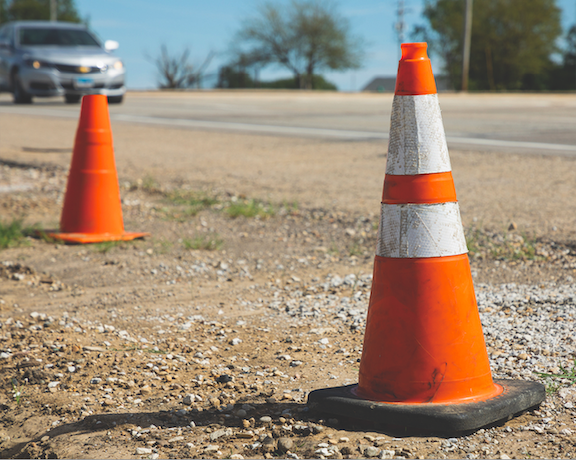
Winds off both Lake Erie and Lake Ontario will combine with snowfall to create difficult travel conditions with blowing snow and reduced visibility. Below freezing temperatures will be very dangerous for motorists who may become stranded. Drivers should avoid any unnecessary travel and allow themselves extra time between destinations and ensure their vehicles are packed with supplies like blankets and water.
In addition to preparing for snow and wind, New Yorkers should also prepare to protect against the dangers that can result from colder weather and winter activities. Under state regulation, a Code Blue is automatically in effect whenever the temperature and wind chill equal less than 32 degrees. Local social services districts are legally required to take necessary steps to ensure those experiencing homelessness have access to shelter and that shelter hours are extended. New Yorkers also should check out these cold weather tips from the Department of Health; additional tips for preventing frostbite and hypothermia information on carbon monoxide poisoning; information on the proper use of generators; and safe winter driving tips.
The New York State Department of Labor advises workers and employers to engage in extreme cold weather best practices such as:
√ Limit outdoor work, provide frequent breaks in warm areas and schedule outdoor work during the warmest times of the day.
√ Ensure access to clean drinking water.
√ Stay hydrated with warm beverages and avoid drinking caffeine.
√ Wear proper PPE, including at least three layers of clothing, gloves or mittens, thick socks, insulated footwear and a hat, hood or hard hat liner.
View more information on best practices for working in cold weather.
Winter storm warnings and winter weather advisories have been issued, and New Yorkers should closely monitor their local forecasts and look for updates issued by the National Weather Service. For a complete listing of weather alerts, visit the National Weather Service website.
New Yorkers can also ensure that government emergency alerts are enabled on their mobile phones. They can sign up for real-time weather and emergency alerts that will be texted to their phones by texting their county or borough name to 333111.
Winter driving safety tips
•Monitor the forecast for your local area and areas you may be travelling to.
•Avoid unnecessary travel.
•If you must travel, make sure your car is stocked with survival gear like blankets, a shovel, flashlight and extra batteries, extra warm clothing, set of tire chains, battery booster cables, quick energy foods, and brightly colored cloth to use as a distress flag.
•If you have a cellphone or other communications device such as a two-way radio available for your use, keep the battery charged and keep it with you whenever traveling. If you should become stranded, you will be able to call for help, advising rescuers of your location.
•The leading cause of death and injuries during winter storms is transportation accidents. Before getting behind the wheel, make sure your vehicle is clear of ice and snow; good vision is key to good driving. Plan your stops and keep more distance between cars. Be extra alert and remember that snowdrifts can hide smaller children. Always match your speed to the road and weather conditions.
•It is important for motorists on all roads to note that snowplows travel at speeds up to 35 mph, which in many cases is lower than the posted speed limit.
•Oftentimes on interstate highways, snowplows will operate side by side, to safely clear several lanes at one time.
•Motorists and pedestrians should also keep in mind that snowplow drivers have limited lines of sight, and the size and weight of snowplows can make it very difficult to maneuver and stop quickly. Snow blowing from behind the plow can severely reduce visibility or cause whiteout conditions.
•Motorists should not attempt to pass snowplows or follow too closely. The safest place for motorists to drive is well behind the snowplows where the roadway is clear and salted. Never attempt to pass a snowplow while it's operating.


1859 Whitehaven Road, Grand Island, NY 14072
Phone: 716-773-7676
Fax: 716-773-7190