
+70
°
F
+74°
+58°
Niagara Falls
Thursday, 16
See 7-Day Forecast
Featured News - Current News - Archived News - News Categories
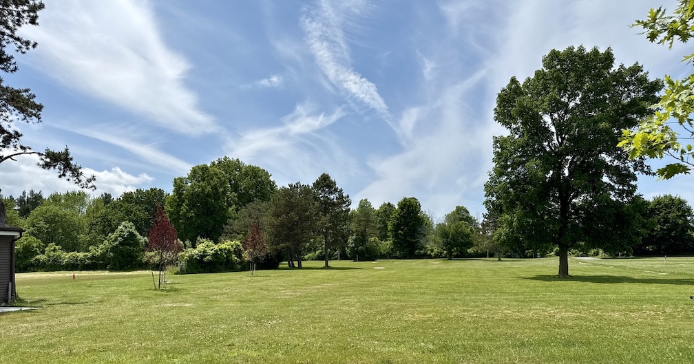
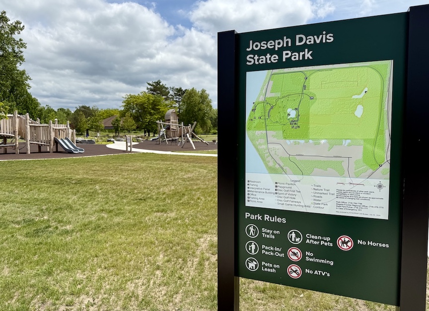
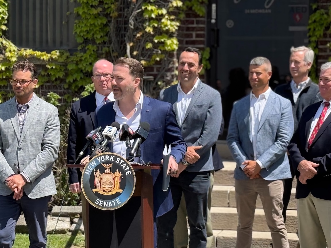
Road closed to become multipurpose trail
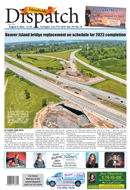
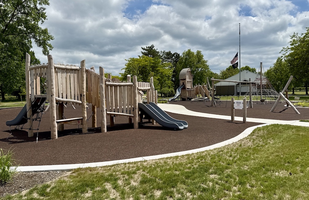
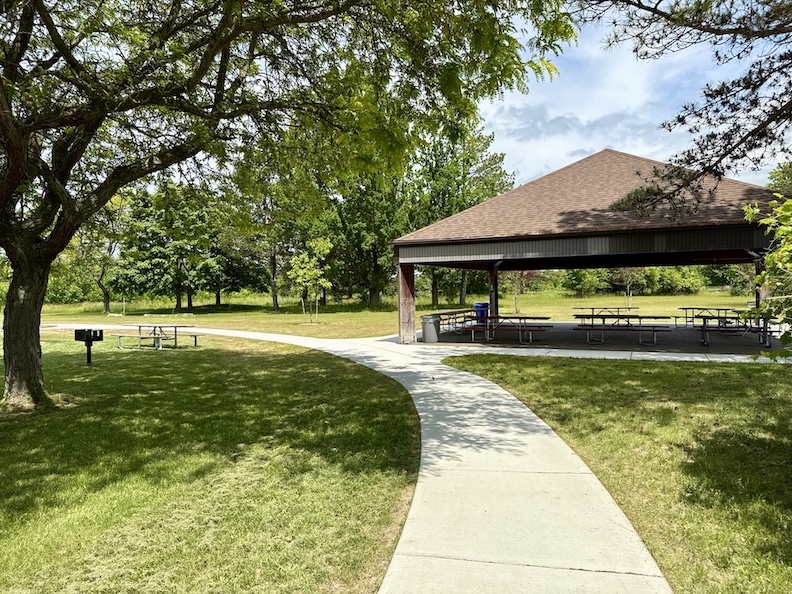
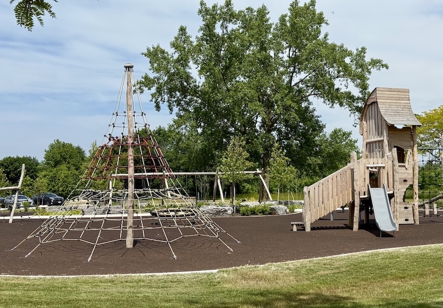
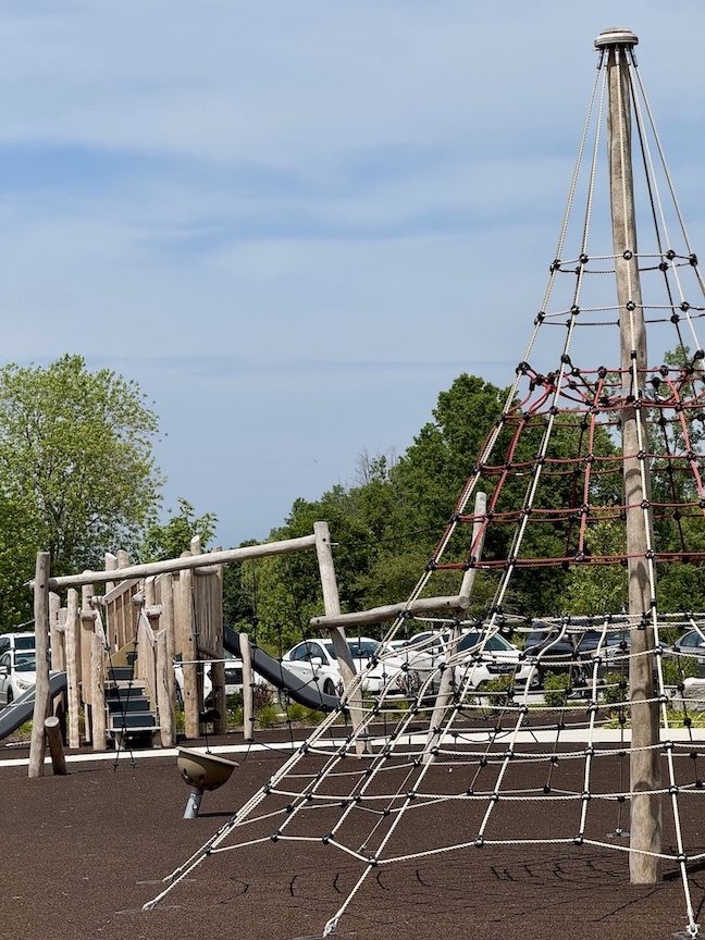
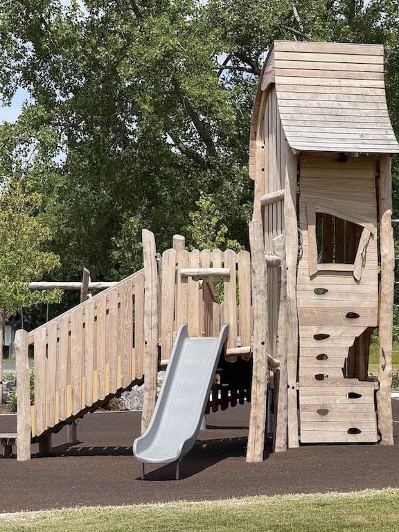
The New York State Office of Parks, Recreation and Historic Preservation cut the ribbon on several upgrades at Joseph Davis State Park in Lewiston, including a new, 1-mile multiuse trail and a new inclusive playground.
At a press conference on Monday, New York State Parks Niagara Region Director Mark Mistretta said, “We’re announcing improvements that have really been transformational to this park. It was sometimes considered the lost child. It needed more love.”
The $3.4 million in work includes:
√ Repurposing of a former seasonal road into a 1-mile-long paved multi-use trail, with trailhead parking areas
√ A new inclusive playground
√ Site improvements to the main parking lot, including pavement removal and added-in green space
√ New multiuse trails and green space around the pavilion
√ Landscaping, best-in-class disc golf course upgrades, park furnishings, and signage
√ Resided concession building
Mistretta called Joseph Davis State Park a “hidden gem.”
“The improvements have really made this park more cherished,” he said. “We’re really excited about it.”
Niagara River Greenway Executive Director Greg Stevens highlighted “a tremendous stretch of safe, family-friendly, bicycle, walking, dog-walking trail that didn’t exist.”
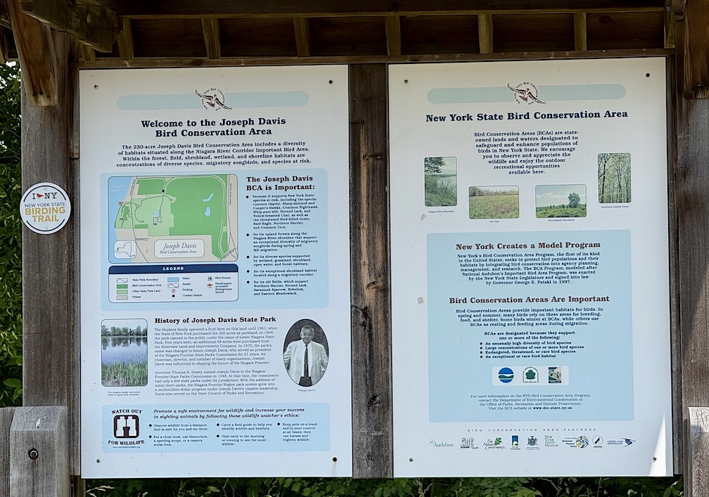
He noted, “This park is an amazing treasure in our conservation habitat inventory in the Niagara Region. The Niagara Region is the single most important bird migratory flyway in North America, and probably the world. The density of populations coming through here is second-to-none in the world.”
Funding came from the Environmental Protection Fund ($500,000), NY Works ($1.3 million), Land and Water Conservation Fund ($900,000), and the Niagara River Greenway/State Parks Standing Committee ($700,000).
Mistretta noted, “There is a fair amount of work done by our own in-house forces” and State Parks trades. “For all you taxpayers out there, you’re getting the biggest bang for your buck.”
Lou Paonessa, representing the New York Power Authority – which provides Greenway funding – said, “I travel by the Pletcher Road entrance regularly, and it’s gratifying to see the use of that entrance already. Just a minor change, but one that’s significant.”
He added, “It’s a nice evolution, and it’s changing to meet the needs of the region.”
Town of Lewiston Supervisor Steve Broderick said, “For our community, for Niagara Falls, for Youngstown, you can go from Niagara Falls State Park all the way down to Lewiston, all the way to this location, with very minimal road crossing.”
Not in attendance, but commenting, New York Power Authority President and CEO Justin E. Driscoll said, "The new enhancements at Joseph Davis State Park will make it easier for visitors to connect with Western New York’s scenic landscape. NYPA’s support of Niagara River Greenway projects is reflective of our commitment to the revitalization and growth of our host communities."
New York State Parks Commissioner Pro Tempore Randy Simons said, “The work we celebrate today at Joe Davis State Park will make it even more attractive for visitors to enjoy quiet trails, serene landscapes and fun playgrounds. All of these amenities go a long way in allowing people to unplug and play in nature, consistent with Gov. Hochul’s initiative to get people off their phones and other devices and connect with each other.”
Work was performed by A-1 Land Care of Lewiston.
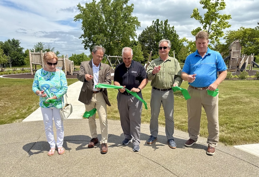
Following the press conference, a ribbon was cut to signify the park’s grand reopening.
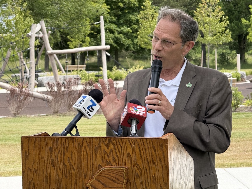
Mistretta
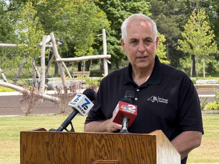
Paonessa
••••••••
New York State Parks announces release of newly redesigned park & historic site system map
The Office of State Parks also announced the release of an updated New York state parks and historic sites map highlighting affordable options for outdoor recreation and culturally enriching experiences. The first update to a statewide overview of facilities since 2017, new additions to the map include recently opened and renamed parks Sojourner Truth State Park in Ulster County and Shirley Chisholm State Park in Brooklyn, as well as the 750-mile Empire State Trail that spans the entire state.
In addition to new facilities, more direct information about recreation opportunities like camping, wildlife encounters and swimming have been added, making it easier for New Yorkers to discover new ways to engage with state parks and state historic sites, recreational trails, golf courses and boat launches.
“The statewide map continues to be a popular resource for our visitors to plan their next trip,” Simons said. “As a public resource that informs our visitors on where they can find affordable recreation opportunities, and as an agency that continues to grow and evolve, it was essential to update the map to provide visitors with the most current information. Our hope is that this updated map will make it easier for New Yorkers to unplug from their devices, participate in activity that improves their mental and physical wellness, and find the recreation and cultural destinations that matter to them.”
Utilizing a modern minimalist design that presents important information more clearly, the map focuses on the details important to New Yorkers like the location of state parks, state historic sites, boat launches, DEC campgrounds, recreationways and their proximity to major routes of travel. These updates reaffirm the state park and historic site map as an important tool for New Yorkers and out-of-state and international visitors to plan their visits and discover exciting new ways to engage with all the agency has to offer.
In addition, the 2025 New York camping guide is now available online and in print. Filled with details about close-to-home campgrounds, the guide features more than 100 photos, a comprehensive listing of all state sites, park descriptions, maps and information on fees, campground amenities and reservation instructions. The guide is also available on the S Parks website.
Found at all state park and historic site visitor centers as well as many local and regional tourism centers across the state, the map is a free publication available to all. Members of the public can request a map or camping guide by emailing notes@parks.ny.gov or by calling 518-474-0456.
Supplementing the new map, information about all state parks and historic sites can be found on the New York State Parks Explorer app. Available for iOS and Android, the app acts as a digital atlas, featuring trail maps, real-time alerts, park contact information, hours of operations, and amenities for all state park and historic site properties. The app also provides ideas for various thematic activities at state parks and historic sites by making use of the Discover section on the home screen.
For more information on any of these recreation areas, visit parks.ny.gov.


1859 Whitehaven Road, Grand Island, NY 14072
Phone: 716-773-7676
Fax: 716-773-7190